Tuesday, October 7, 2008

You're all clear kid...

In the previous post, I was just going to sleep at the campground at the Grand Canyon. As I woke up, it suddenly occurred to me that this was the last action day of the trip. So at around 4:30 in the morning, I was up and about and on my way to see the sun rise over the Grand Canyon. Taking what I can only refer to as a "Trent" moment, I found myself staring at the still dark sky. There were no clouds and the number of stars was amazing. I wish I could say this was the most stars I had ever seen but it's actually 2nd. When I was 18, I had the very fortunate opportunity to go to Australia/New Zealand/Fiji. When our group arrived in Fiji, it was like 2 in the morning and I'll never forget that when I stuck my head out the window of the bus, I could see more light than dark in the sky from all the stars. It was amazing. Now where was I (literally)?


Oh yeah, so I eventually made it to the rim and positioned myself for the sunrise. I was amazed how many people make it out for this event. Here's a pic and a video. I took a video right when the sun came out over the canyon and you can almost watch it move while it's at its low point in the sky. Warning - the video is very uneventful but it puts you there more than a picture. *Okay, I'm having some technical difficulties at the moment. It seems the video doesn't want to load. If I can get it to work, I'll post later.


After the sunrise session, I took the car as far as I could to Yaki Point. I chose this little hike into the canyon because a) it didn't look that hard and b) it was far enough away from the more popular trails down. I could've easily called this post "Watch out for the mule shit" because that's what I spent the majority of the hike doing. It's weird because I didn't see a mule. Ghost mules?

Anyway, I was excited to leave the rim of the canyon and get down in it. In fact, this is what I looked forward to more than anything else on the trip. This first pic was taken just after I started on the trail. Finally, the sun was out and started casting some good shadows.


Here are some random pics on the way down.


In that last picture, if you look carefully (or zoom in) at the bottom right of the shot, there's a little blue shack that is a restroom on the trail. This is a little rest stop for the folks continuing down (or up for that matter). This was as far down as I was going. Here's a better shot as I approach as you can see the people at the bottom right.


Once I made it down there, I figured I was about 1/3 of the total way down the canyon but maybe a little less than that. The trail was only a little over 2 miles to that point. Anyway, like at most places, I wanted to get away from all the people so I walked out on the ridge as far as I could. That was pretty cool. Anyway, here are some shots from down there including one of me messing with the timer on the camera (and not getting exactly set btw) and the video I took down there (video coming later unfortunately). I hope you enjoy.


Once I did my regular "sit and think" thing for a while, I started the trek back up. It actually wasn't that bad compared to going up the Grand Tetons. Or maybe I was starting to get used to all this activity. Who knows? On the way back up, I saw this family taking a rest. The husband/father out of the blue asked me if I spoke English. I wanted to go all Ferris Bueller on him and say, "Um, what country do you think this is?" but I kept my tongue quiet and simply answered yes. I can understand why he asked because even with all the foreigners around at other national parks, there was an even higher percentage at the Grand Canyon. Anyway, he (the dad) was having what can only be called "an emergency" and needed to go back up. So we were walking up together and he asked where I was from. I said, "North Carolina" and then he replied, "Oh, you must like Andy Griffith." To which I replied, "Yeah, let me find my bullet." I'm guessing he didn't get it but it pisses me off that that's the only thing my great state is associated with - at least in this idiot's mind. At least he didn't ask about the frickin' Tarheels.

After I made it back to the car, I still had to pack everything up at the campsite. It finally hit me that this was it. My trip was pretty much over except for the drive back to Salt Lake City and the flight home the next day. I did come across some cool stuff. This picture is an entire storm moving through the area. I'm not sure why but I really thought this was cool. I mean, I've seen storms before like at the beach or something but this one was different because again, you could see forever.


I then made the impulsive decision to drive through Zion NP and at least see what it's all about. I knew I wouldn't be able to do it justice but since I thought I had plenty of time to get back up to SLC, I would give it a shot. The park was only about 30 minutes out of the way.


The big difference was that you are already in the canyon once you go through this rather lengthy tunnel entering the park from the east. Then it opens up to stuff like this...


Once I got to the parking lot, I discovered that there's a shuttle bus that runs every 10 minutes or so that takes you up north in the canyon following along the river. I though what the heck and hopped on. First of all, it was insanely hot in this canyon. Second, most people on the unairconditioned bus didn't smell all that good - including myself. Let's review, I slept in a tent with no shower, I hiked about 4 or so miles at the Grand Canyon, and I'd been stuck in a car for about 4 hours. Yeah, I probably smelled. Anyway, it was pretty neat otherwise to get a quick glance at the park. Turns out there's some excellent hiking spots in there so maybe one day I'll head back and see what I can get into. Here's a few shots taken from the bus (and in one, you can see another bus - and I know you really cared about what the bus looked like!).


I made it to my hotel in SLC around 10:30. The next day I would fly back to reality. This trip that I planned for the better part of 2 months was quickly coming to an end. I slept great that night and aside from my luggage not making it back with me, the flights were uneventful.


I plan on writing one last post where I hope to leave you with some parting thoughts...a lessons learned sort of thing.


Venture on, put simply, just venture.

Thursday, September 25, 2008

That's one grand canyon!

Okay, we're in the home stretch here people. Let's finish strong. I'm having a blast writing on this thing but sometimes it proves difficult to find the time - especially while taking 2 MBA classes this semester, it being football season, all the new fall TV, and oh yeah, work and personal life. I don't see how some people do it (*cough* tripjax).

Anyway, at the end of the last post, I was tooling around Canyonlands NP wanting to pull a Bear Grylls and just walk forever (but without the film crew and the misleading notions of isolation) and believe me, this was the place for it. But after Canyonlands, I had about a 3 hour drive to a little town called Richfield, UT where I was staying the night at some crappy Quality Inn (and yes, I'm aware of the irony). There wasn't much to Richfield - just a small town right off the interstate - but they did have a Home Depot and a Wal-mart (don't they all).
A quick/funny story about the hotel. I remember the front desk lady being all excited that she was able to give me a room by the stairs. I didn't think anything of it but this turned out to be the worst thing possible. Seems that at 4 in the morning, I was awakened by numerous jackasses running up and down the "great to be located next to" stairs. Although, I guess it could've been the same jackass...just over and over. Since I was "awake", I figured I'd fake a trip out to the car and find out what was going on. Here's a slightly paraphrased conversation held in the dark of a bad hotel parking lot :
Me - So are you guys a construction crew at the hotel?
Guy (apparent leader of crew) - No, we're a seismology team taking readings south of here.
Me - Oh, that's cool. Because I thought with all the noise you were remodeling some of the rooms.
It went downhill from there but I couldn't go back to sleep so I guess I was able to get a jump on the day. From Richfield, I was driving south to Bryce Canyon NP and then on to the Grand Canyon. I had a good friend tell me to be sure and hike down into Bryce Canyon but after spending the previous two days in Arches and Canyonlands, I thought I knew what was coming. Then I came to this.


Heck yeah I was going down there! Seems that the canyon was formed due to erosion (like any other canyon) but also because ice freezes (or is it already frozen?) and then expands in the rock to form the cool spires. It's science. On the way down, I came across this - Thor's Hammer (say it like the movie voice over guy). No joke, that's what it's called. But cool too.


And this is the trail down to the canyon floor. I should note, this is a vertical panorama (2 pics put together) but you get the idea of how far down it was.


Here's a few pics in the canyon and from the way back up.


Check out the person in this pic compared to the tree.


This is the opening in the canyon you come out of before the trek back up.


And this is what you have to hike up - back and forth and back and forth some more.


Finally, the pic from the top looking back down.


After getting back to the top, there was still plenty of the park to see. So once I made it back to the car, I continued south on the main park road and had planned to head all the way to the southern most point of the park. However, the rangers in the middle of the road thought differently. It seems they were doing some controlled burns in that section of the park so the road was closed...and so was my Bryce Canyon experience. I guess it was okay. I had to drive to the Grand Canyon anyway.

Speaking of that, I was coming from the north driving south to the south rim of the Grand Canyon (by far the more visited rim) which seems easy enough, right? Well, before the trip I was looking at the map and doing some simple calculations, I figured it would take about 3 hours just to get around the Grand Canyon. Turns out I was right. Seems pretty unreal that something is sooo big it takes 3 hours to drive around. Anyway, here's a quick video of me losing my mind driving in the wide open.


Once again, before the trip, I had picked out a spot I wanted to check out and the below video is from that spot. It's actually at the "start" of the Grand Canyon with the Colorado River below. Let me tell you, I've experienced hot before but getting out of the car and walking across that pedestrian bridge was probably the hottest I've ever experienced. During the video, I leaned over to show you the river below and my arms touched the metal railing. You're lucky you didn't get a few choice words in there.


Eventually, I did actually make it to the Grand Canyon. Like most people, I stopped at the first lookout just because I was so anxious to see it. My first reaction was, "this is one big *bleepin'* hole." After a disappointing stop through the ranger office and a couple stores, I decided to check out some of the more popular lookouts. Then for the first time on this entire trip, it rained (but only for about 20 minutes). The rain cooled things off but because it was so cloudy, it messed with the light/shade of the canyon which can be the best part. I should mention that one of the most interesting things in the ranger station was a series of pictures of exactly the same view at different times throughout the day. None of the pictures looked the same because the shadows made it seem like you were looking at an entirely different scene. Anyway, here's proof I was actually there.


Here are some more pics of the canyon. This first one is the view of one of the overlooks from the one next to it. Gives you a good idea of the initial drop from the canyon ridge (about 800 feet or so).


This is the view from the same overlook as the previous picture but more centered in the canyon. Keep in mind, the Grand Canyon is 10 miles wide at its farthest point and 1 mile deep from canyon ridge to the Colorado River.


Suffice it to say, I was completely blown away by this thing. So much so that I think everyone should see this for themselves at some point in their life.

It was starting to get a little late in the day and I still needed to check into the campground before they closed. After that, I wanted to find a decent place to eat. But first, I found a lounge and enjoyed the crisp, clean flavor of a few Fat Tires (beer only available west of the Mississippi). Because the chair was so comfortable (*cough*), I stayed and had a burger (and a good burger at that). So once again, after a fairly exhausting day and a little fire I made, I laid down my head on my make-shift pillow consisting of a sweatshirt stuffed in my sleeping bag bag. Ah, vacation. As I went to sleep, I looked forward to getting up well before the sun and watching it rise over the canyon.

Venture on, venture in a high MPG vehicle.

Saturday, September 13, 2008

She Blinded Me With Silence

So now it's day...whatever. I don't know. It's been 3 weeks since getting back from my trip and I'm trying my best to remember everything given limited documentation. It's weird because at work or whenever, I try to hold onto an image in my head of somewhere I've been on this trip. It's proving quite difficult and I hope that I don't lose those over time. It's pretty cool when I can make it happen though. Like sitting at my desk and all of a sudden I'm on that trail in the Grand Tetons staring at the lakes below. Interesting how the mind works.


Anyway, after a full day at Arches and a restful night once again in a hotel, I was off to Canyonlands. This post could very well also be called "Driving, Hiking, Sitting, Staring" because I certainly did a lot of all of those. Today was booked with a huge hike down into and around the Upheaval Dome (as previously posted in real time). All told, the hike was over 12 miles round trip and if I truly thought about it beforehand, I would've been crazy to try this.


As I mentioned, this hike was "not advised" during the months of July and August. Of course, I found this out at the trail head. Oh well, another bad sign but I was doing it regardless. Everything was going fine (sort of) on the trail. I mean, it was severely sloped but not too bad. That is, until I came to this point. And I hope you enjoy the commentary (throat was a little dry).


I'm really glad I decided to stop there and turn around. But before I made the trek back up, there was a perfect natural chair in the rock immediately behind me where I shot that video. Given this, I decided to sit for about 30 minutes and have some really good inner conversations. But in just sitting there eating my Clif bar and drinking my water, I noticed something really, really weird. There was no sound. I mean nothing. Try this out...next time you think it's really quiet where ever you are, pay close attention. It seems there's aways crickets or an air conditioner kicking on or a dog barking or even the wind. Worse yet, we have cars and planes and all that other stuff that contributes to the noise of our daily lives. But imagine nothing. It's hard, yes but still imagine the loudest thing being your body exhaling or your foot hitting on the trail. It was something that I've never experience before but for all its weirdness I hope I do again. And for the record, there were no other people on this trail. Usually I would see people coming and going and milling about but this hike there was nobody...and that made me smile (given my increasingly introverted notions).


So here are some pics of the Upheaval Dome from up top since my trek to get pics from inside the thing didn't work out. For a sense of scale (something I always like to point out), the dome itself is over 3 miles across. Of course, there were these overlooks where I could've stood with the masses so I chose instead to find a quiet spot away from all that and chill with my thoughts. Chill, of course, being merely an expression...yeah, it was hot. Here's some info on the dome if you're interested...http://www.nps.gov/cany/naturescience/upheavaldome.htm


And then there's wiki too...http://en.wikipedia.org/wiki/Upheaval_Dome

(These shots below are intended as a panorama going from left to right.)


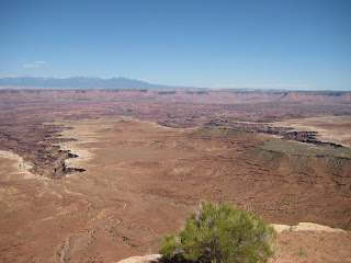
For the remainder of the day, I just hit some of the pull-offs and soaked it all in as best I could so here are plenty of pics from the rest of Canyonlands. I tool a lot more but you get the idea. Pretty amazing, huh? I can honestly say I've never seen so far in my life.


Finally, I'll leave with the front of my tattered rental car.


Venture on, venture in awe.

Sunday, September 7, 2008

Fade to Orange

After a not so great night's sleep (stupid gravel at the campsite), I had to drive all the way down to Moab, UT which I expected to take about 10 hours. I got all packed up and headed off saying goodbye to Wyoming for more than likely the last time ever. Thankfully, the drive was pretty uneventful but I was already getting sick of fast food (although that biscuit was pretty dang good). Thank God for XM radio. Best part of the trip was a bit from the XM comedy station. Mitch Hedberg (one of the greats) said, "I once applied for a job at an insurance company. The manager asked me, 'So where do you see yourself in 5 years?' I said, 'Hopefully celebrating the 5th anniversary of you asking me that question." I almost wrecked the car.

Anyway, I was able to get into Moab around 7 and after checking into the hotel (finally, a hotel!) and getting a much needed shower, I wanted to check out the Moab Brewery/Restaurant. If you ever find yourself in Moab (and you like local beers), this is the place for you. The food was great too. Anyway, I wanted to get a good night's sleep in a hotel bed but I ended up watching the Olympics until about midnight. Stupid national pride.


So the next day would be spent in Arches National Park and I have to tell ya, it's amazing how the landscape changed. The day before it was nothing but greens and blues and now being in southern Utah it was all orange and browns. And you could see for...ev...er. Absolutely amazing.
When I made it into the park, this was the first thing I saw at a little turnaround. Looks like something out of the Road Runner. More balanced rocks to come.


Before the trip, I had decided to include the Devil's Garden trail which had several cool arches to see along the way. Well, about a week before I left, one of those cool arches decided not to be so cool anymore and collapsed. Because of this, the main trail was closed but the "primitive" trail was still open if you wanted to get to the Double O arch (at trail's end). I didn't think it was going to be that big of a deal so I still planned on heading out that way.
Shortly after starting, I discovered that this trail was like walking on the beach. And not the hard compact sand kinda beach. I'm talking about the soft and fluffy sand kinda beach. For the lack of a better word, it sucked but incredible scenery. Enough of my whining, here's the goods (and keep in mind, I didn't come near taking pictures of all of them).
Tunnel Arch (not that spectacular)

And here's Pine Tree arch. At first I thought I was ruining these pictures if someone was in them but it actually gives it some scale (which is severely lacking in some of these pics).


Landscape arch - which looks like it can go at any moment.


Here's just a cool rock formation along the way...no official name but I call it Cool Rock Formation.


Here's a few pics from the top of what can only (and non-scientifically) be called a big, long rock. Notice the people in the first one. They eventually left the top and I was up there all by myself looking down to the hikers below. Of course, I had to go all the way to the end. The last one shows a couple on the trail and how high this "big, long rock" was.


Here's a shot of the "trail." Seems the primitive trail is just that. You can see the trail marker there. Notice how there's a slope of the rock and the wear pattern where all have walked? Yeah, that's the trail. Fairly high up too.


Finally, the Double O arch. This one was worth the hike. For a scale, the bottom arch is probably 12 feet high so the big one is probably big enough to fly a small plane through. Also, check out the guy on top.


Funny story about that guy on top. As I sat way high up on this little ridge overlooking the arch, that guy set up a camera on a tripod far over to the right on top of the whole thing. I'm watching this wondering what he was up to then all of a sudden, he takes off running to the left and went all the way to the end, turned around, and started jumping up and down. Seems that he set his timer and wanted a picture of him on the complete other side of the arch. Quite the entertainment. A few groups came through but I must have sat there for about 45 minutes before making my way to Dark Angel. Not all that spectacular but this thing was just all by itself. And this pic was taken at least 500 yards away.


I'll end this post with just a couple more pics and then I better go. Here's probably the best trail marker I saw all trip. See, when the trail runs on rock (as a lot of these did) and you can't tell which way to go, you need to mark the trail somehow. What better way than with the unnatural stacking of small flat rocks? You get the idea. It's also good luck to contribute.


And finally, Balanced Rock. Called so for obvious reasons. And can you believe the sky that day?

Venture on, venture with sunscreen.